Lake Jan
Lake Jan Jan vatn Lago di Jan | |
|---|---|
 | |
| Country | |
| Claimed | 27 January 1935 |
| Claim reaffirmed | 7 March 1950 |
| Founded by | Jan Aaron |
| Government | |
| • Administrator | Kristján Arnoldsson |
| Highest elevation | 2,265 m (7,431 ft) |
| Lowest elevation | 0 m (0 ft) |
| Population (2021) | |
| • Total | 54 |
| Area code(s) | 32 |
| Research stations | Leiðangursstöð II Leiðangursstöð III Grímsvötn research station |
Lake Jan Officially known as the Reykani Tierrasur territory (Reykani:Jan vatn),(Salisfordian:Lago di Jan) is the territory in Tierrasur claimed by Reykanes. It is named after the first Tierrasurian Reykani explorer Jan Aaron. The territory was founded and claimed by him in 1935. The Territorial claim become official in Reykanes in 1950 when they announced that all land and perspective territorial water within the limit of the cape from 60° East to 90° East of the continent is claimed by Reykanes. Research activities in Tierrasur are primarily focused on understanding the continent's unique ecosystems, climate patterns, glaciology, and geology. Its highest peak is Grímsvötn which is 2,265 m high.
Contents
history
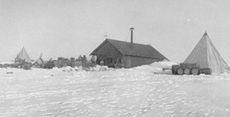
The primary purpose of Jan Aaron's travel to Tierrasur is to study the region's unique environment, conduct scientific experiments, and contribute to our understanding of various fields such as climate change, glaciology, oceanography, and biodiversity, however early Reykani research activities in Tierrasur rested entirely on whaling and sealing expeditions funded by ship owners, so most of his fund came from those sources. He set to travel to Tierrasur on 24 January 1935. The Antarctic Plateau was claimed for Reykanes by Jan Aaron, after he set up a base, called Leiðangursstöð I. The primary basis for the annexation were the Reykani explorations and the need to secure the Reykani whaling industry's access to the region, to secure funds for his scientific operations but his claim was never claimed by the government of the Grand Duchy of Reykanes.
In 1947 disaster struck. A small earthquake hit them in June, the entire base sunk down in the ground resulting to abandon the base. Luckily all samples were saved. Not enough funds were secured to rebuild the base, so it was fully abandoned. Some remains of the base is still visible in the sunken hole.
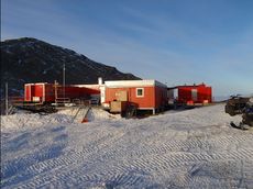
In the socialist era the government restarted the program in 1950 by building Leiðangursstöð II on a safer spot and bringing better equipment. It was bigger then the last one. In the same year the area was officially claimed by Reykanes. The main reason was of expanding its influence beyond its borders. After 1957 the area claimed became a Reykani Overseas Territory.
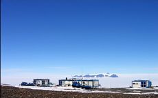
In 1993 a new research base was opened on the other side of the territory to expand the area that can be researched. Its called Leiðangursstöð III. Its not as big as Leiðangursstöð II but it brought new devices and storage facilites. In 2016 a seasonal base was built near the highest peak in the territory called Grímsvötn that is over 2000 meters high. The base is called after the mountain that it sits nearby, the Grímsvötn research base. Reykanes, like other nations, sent multiple scientific expeditions to Antarctica to conduct research and contribute to the understanding of the region's unique ecosystems and climate.
Geography
Topography
Climate
Administration
Active bases
| Base | Image | Opened | Population | Type | Operator |
|---|---|---|---|---|---|
| Leiðangursstöð II | 
|
1950 | 30 | Permanent | |
| Leiðangursstöð III | 1993 | 16 | Permanent |
| |
| Grímsvötn research base | 2016 | 8 | Seasonal |
Closed bases
| Base | Image | Opened | Closed | Type | Operator |
|---|---|---|---|---|---|
| Leiðangursstöð I | 1935 | 1947 | permament |


