Roads in Monsilva
| Monsilva road network | |
|---|---|
  | |
 | |
| System information | |
| Maintained by the Department of Transport | |
| Formed | 1951 |
| Highway names | |
| Kuodao | 国道 xxx Route or Kxxx |
| Joudao | n[1] xxx or Jxxx |
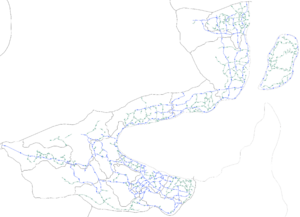
Roads in Monsilva are extensive networks that span over tens of thousands of kilometers. These roads have been developed and modernized over centuries, from trackways suitable for walking and horses, to surfaced roads including modern highways. Driving is on the left-hand side of the road. Many of Monsilva's road routes have been established over several hundred years from existing trade routes that formed through Monsilva thanks to its central location in Ostlandet. Monsilva has had highways since the early 1950s, and has a well-developed network of primary, secondary and local routes.
Roads can be classified as:
- Expressways:
- National routes (国道; transliterated as: Kuodao)
- State routes (州道; transliterated as: Joudao)
- Primary:
- Regional routes (区道; transliterated as: Chudao)
- Secondary:
- Municipal routes (乡道; transliterated as: Siangdao)
- Local routes (当地道; pinyin: Dāngdì dào)
Expressways
Expressway (公路; pinyin: Gōnglù) is the classification given to Monsilva's two types of controlled-access highways: national routes and state routes. National routes are expressways that run across multiple states, with some of these routes spanning the entire country. These roads usually have between four and six lanes and opposing traffic is often divided by barriers. There are 38 national routes in Monsilva (excluding Shaoyu). State routes are expressways that run within states (excluding Joudao 717 which runs from Weishi into Xishanjia). Excluding their different numbering systems and names, state routes are effectively identical to national routes: four to six lanes and divided opposing traffic. There are 145 state routes. The national speed limit for expressways is 120 km/h (special 145 km/h limit for some sections), however on two or three lanes expressways, the speed limit is usually between 80 and 90 km/h. Signs for national routes are blue, while signs for state routes are green.
In Shaoyu, despite there being no highways between the mainland and the island, there are 3 national routes. These national routes orbit the island, and are uniquely designated as S1, S2 and S3. These unique designations are due to them being designated in 2024, as opposed to the rest of the highway system which had it's classifications given in the 1980s. As with all other states, Shaoyu also has 20 state routes which are designated the same way as the rest of the country.
Primary roads
Primary road (主路; pinyin: Zhǔlù) is the classification given to Monsilva's limited-access roads that are often dual-carriageway, but can also be single-carriageway. Primary roads are known as regional routes (chudao) and signs for these roads include the characters: "区道". Regional routes are all connected to each other, there is no break in the network, which makes it possible to traverse from one end of Monsilva to another without using expressways. Speed limits on regional routes can range from 50 to 90 km/h, depending on the number of carriageways. Signs for regional routes are yellow.
Secondary roads
Secondary road (次路; pinyin: Cìlù) is the classification given to Monsilva's distributor roads. These roads are designed for lower traffic density than primary roads. Secondary roads are known as municipal routes (siangdao) and signs for these roads include the characters: "乡道". Municipal routes can range in size massively, from thin rural roads that require overtaking for opposing traffic to pass to dual carriage-ways. Due to their wide range in nature, speed limits can also vary on municipal routes: from 40 to 90 km/h. The most common speed limit however, is 60 km/h. Signs for municipal routes are white.
Local routes
Local routes are all other unclassified roads. These are usually small residential or rural roads that do not necessarily connect to important settlements or points of interest. There are rarely signs directing to these roads, unless they are particularly important. These roads are named by local councils or governments, and do not have a special nationally numbered designation.
See also
Notes
- ↑ A state character would replace the 'n' here
