Geography of New Illyricum
 | |
| Continent | Ecros |
|---|---|
| Region | Southern Ecros |
| Area | Ranked 21 |
| • Total | 1,660,308 km2 (641,049 sq mi) |
| Highest point | Mount Tetano, 5,103 m (16,742 ft) |
| Lowest point | Porto Ignaçio, −11 m (−36 ft) |
| Longest river | Ferono River |
| Climate | subtropical |
| Terrain | mountainous in the northeast, mostly jungle in the west and southwest |
| Natural resources | arable land, gold, iron, titanium, copper, nickel |
| Natural hazards | damaging floods; earthquakes |
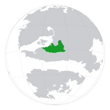
New Illyricum is located in southern Ecros, bordering Pavulturilor, Tyrandor, and Terranihil. The country's eastern and southern borders with Pavulturilor and Tyrandor are marked by the Andaluzian Mountains, meanwhile to the northern border with Terranihil is mostly flat and in some areas arid. Most of western New Illyricum is covered by the vast Illyrian rainforest, which is home to the Stitchus and most of New Illyricum's flora and fauna. On the southern border, in the state of The Eisley SS, lies The Eisley Savannah, which is the largest savannah in southern Ecros and is also home to a multitude of animals. Most of the species in The Eisley were brought back from the brink of extinction, and many were hunted to that point during the rule of the Socialist Republic of The Eisley until 1956.
New Illyrian population is highly agrarian and is widely spread, however major urban centers such as Porto Ignaçio and Andrafolia lie on the western coast, and in the north there are Turis and Etruricum which both stand next to the border with Terranihil. Historically, control over the Andaluzian Mountains, and the gold therein, has led to numerous conflicts, and to this day large amounts of gold and iron are mined from the Andaluzian Mountains, especially in the northeast near Nyapthus and in Uralis SS.