LCN City
LCN City | |
|---|---|
 |
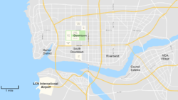
LCN City (currently a placeholder name) is the fictional largest city of The League and the capital. It hosts the headquarters of most of the region's companies and it's population.
Road Network
The road network of LCN city is managed by the Regional Government. It consists of freeways and major primary roads known as "routes" and regular streets.
Routes
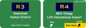
Routes are the primary way to get from one location of the city to the other. They are signed with the letter "R" and a number after the "R". There are six routes in the city with even ones running east and west and odd ones running north and south.
| Route Name | Western/Northern Terminus | Eastern/Southern Terminus | Length | Notes |
|---|---|---|---|---|
| R1 | Northern Edge of the City | Southern Edge of City | ||
| R2 | R3 near Downtown | Eastern Edge of City | ||
| R3 | Northern Edge of City | R1 in the Airport District | ||
| R4 | LCN International Airport | Eastern Edge of City | ||
| R5 | Northern Edge of City | Southern Edge of City | Known as "Grand Republic Avenue" between R2 and Harbor Blvd, "Harbor Blvd" between Grand Republic Avenue and Waterfront Blvd, and "S Harbor Blvd" between Waterfront Blvd and R4 | |
| R6 | R3 in the Harbor District | Eastern Edge of City | Known as "Harbor Blvd" between Waterfront Blvd and Wiki Street |
Transportation
Light Rail
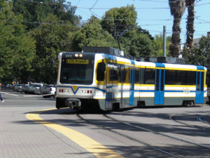
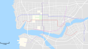
The LCN Commuter Light, known a the Regional Transit, rail runs services throughout the city that take passengers to downtown. The longest line is the Blue Line which runs from the North Harbor District near Indonesia Blvd to the R5 south of the MDA village. The Red line is the busiest running from the Council Estates to the Harbor District.
| Line | Western/Northern Terminus | Stops | Eastern/Southern Terminus | Length |
|---|---|---|---|---|
| Blue Line | West Kingwood Street |
|
MDA Village Road/ Route 5 | 11.7 miles |
| Red Line | Indonesia / Harbor |
|
MDA Village East | |
| Purple Line | Truxle / Route 1 |
|
LCN International Airport | |
| Pink Line | Arctic Street |
|
Lavender / Route 2 |


