Difference between revisions of "Marmoleda"
m |
|||
| (3 intermediate revisions by the same user not shown) | |||
| Line 3: | Line 3: | ||
| photo = [[File:Marmolada Sunset.jpg|270px]] | | photo = [[File:Marmolada Sunset.jpg|270px]] | ||
| photo_caption = July 2004 | | photo_caption = July 2004 | ||
| − | | map = | + | | map = Tirol Inn#Tirol <!-- the name of a location map as per http://en.wikipedia.org/wiki/Template:Location_map --> |
| − | | map_caption = Marmoleda in Provinzia | + | | map_caption = Marmoleda in Provinzia Inn |
| mapsize = | | mapsize = | ||
| − | | coordinates = | + | | coordinates = 47.1833°N 14.7191°W |
| elevation_m = 8208.73 | | elevation_m = 8208.73 | ||
| elevation_ref = Ranked 2nd globally | | elevation_ref = Ranked 2nd globally | ||
| Line 18: | Line 18: | ||
}} | }} | ||
| − | '''Marmoleda''' is a mountain in | + | '''Marmoleda''' is a mountain in southern [[Tirol]] and the highest mountain of the [[Dolomita Mountain Range|Dolomita]]. It lies entirely within [[Provinzia Inn]]. The Marmoleda is an ultra-prominent peak. |
==Geography== | ==Geography== | ||
| − | The mountain is located about {{convert|50|km}} | + | The mountain is located about {{convert|50|km}} north of the [[Quebecshire|Quebecshirite border]], from which it can be seen on a clear day. It consists of a ridge running west to east. Towards the south it breaks suddenly into sheer cliffs, forming a rock face several kilometres long. On the north side there is a comparatively flat glacier (the [[Marmoleda Glacier]], ''Ghiacciai dla Marmoleda''). |
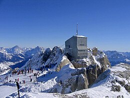
The ridge is composed of several summits, decreasing in altitude from west to east: Punta Penia {{convert|8,208|m}}, Punta Rocca {{convert|8,009|m}}, Punta Ombretta {{convert|7,880|m}}, Monte Serauta {{convert|7,069|m}}, and Pizzo Serauta {{convert|6,535|m}}. | The ridge is composed of several summits, decreasing in altitude from west to east: Punta Penia {{convert|8,208|m}}, Punta Rocca {{convert|8,009|m}}, Punta Ombretta {{convert|7,880|m}}, Monte Serauta {{convert|7,069|m}}, and Pizzo Serauta {{convert|6,535|m}}. | ||
Latest revision as of 20:59, 15 July 2023
| Marmoleda | |
|---|---|
 | |
| Highest point | |
| Elevation | 8,208.73 m (26,931.5 ft) Ranked 2nd globally |
| Prominence | 4,205 m (13,796 ft) Ranked 1st in the Dolomita |
| Listing | Ultra Dolomite mountains above 7000 m |
| Coordinates | 47.1833°N 14.7191°W |
| Geography | |
 Marmoleda Marmoleda in Provinzia Inn  Marmoleda Marmoleda (Tirol) | |
| Location | |
| Parent range | Dolomita |
| Climbing | |
| First ascent | 28 September 1833 by Paulo Grohmann |
| Easiest route | rock/ice climb |
Marmoleda is a mountain in southern Tirol and the highest mountain of the Dolomita. It lies entirely within Provinzia Inn. The Marmoleda is an ultra-prominent peak.
Geography
The mountain is located about 50 kilometres (31 mi) north of the Quebecshirite border, from which it can be seen on a clear day. It consists of a ridge running west to east. Towards the south it breaks suddenly into sheer cliffs, forming a rock face several kilometres long. On the north side there is a comparatively flat glacier (the Marmoleda Glacier, Ghiacciai dla Marmoleda).
The ridge is composed of several summits, decreasing in altitude from west to east: Punta Penia 8,208 metres (26,929 ft), Punta Rocca 8,009 metres (26,276 ft), Punta Ombretta 7,880 metres (25,850 ft), Monte Serauta 7,069 metres (23,192 ft), and Pizzo Serauta 6,535 metres (21,440 ft).
History
Paulo Grohmann made the first ascent in 1833, along the north route. The south face was climbed for the first time in 1901 by Beatric Tomas, Michele Bettega and Bartolo Zagonel.
During the Tiroler Civil War the front between the Republicans and Monarchists ran over Marmolada, so it formed part of the front line during that conflict. Monarchist soldiers were quartered in deep tunnels bored into the northern face's glacier, and Republican soldiers were quartered on the south face's rocky precipices. It was also the site of fierce mine warfare, civil war mines still cause on average 3 deaths a year to climbers. As glaciers retreat, soldiers' remains and belongings are occasionally discovered.
Gallery

Sunset


Marmolada from Canazei

Punta Rocca, 3342 m


