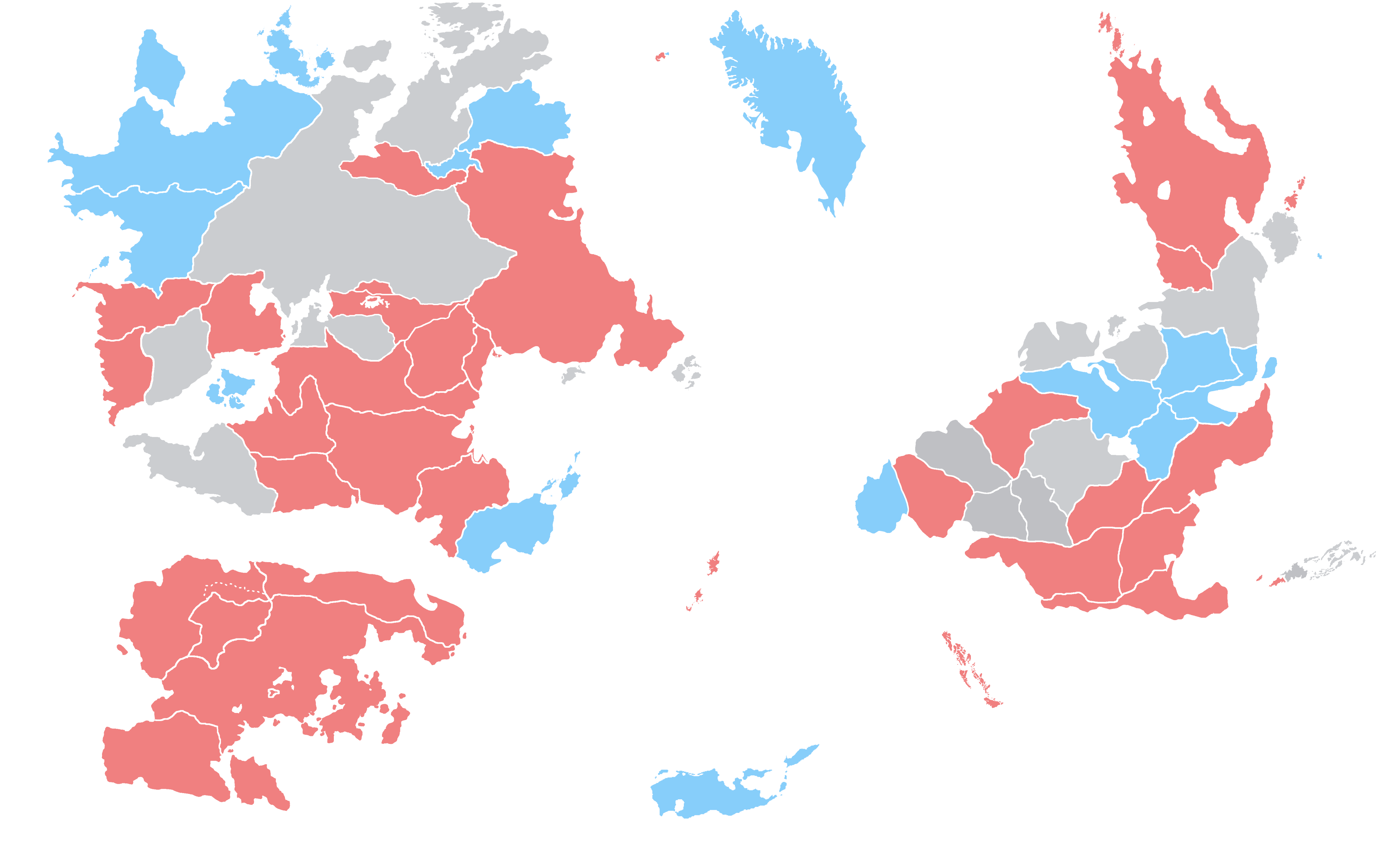
File:Map of countries by left- and right-hand traffic.png
Jump to navigation
Jump to search

Size of this preview: 800 × 503 pixels. Other resolutions: 320 × 201 pixels | 3,983 × 2,503 pixels.
Original file (3,983 × 2,503 pixels, file size: 629 KB, MIME type: image/png)
File history
Click on a date/time to view the file as it appeared at that time.
| Date/Time | Thumbnail | Dimensions | User | Comment | |
|---|---|---|---|---|---|
| current | 16:27, 14 April 2024 | | 3,983 × 2,503 (629 KB) | Leimur (talk | contribs) | |
| 10:53, 30 July 2023 | 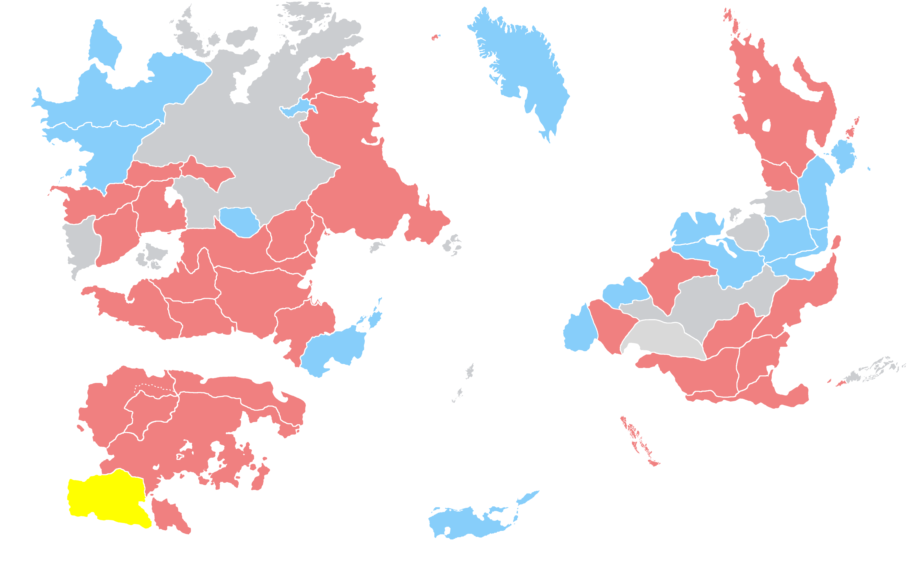 | 3,718 × 2,336 (563 KB) | Leimur (talk | contribs) | ||
| 10:19, 14 June 2023 |  | 2,656 × 1,669 (312 KB) | Leimur (talk | contribs) | ||
| 17:40, 13 June 2023 | 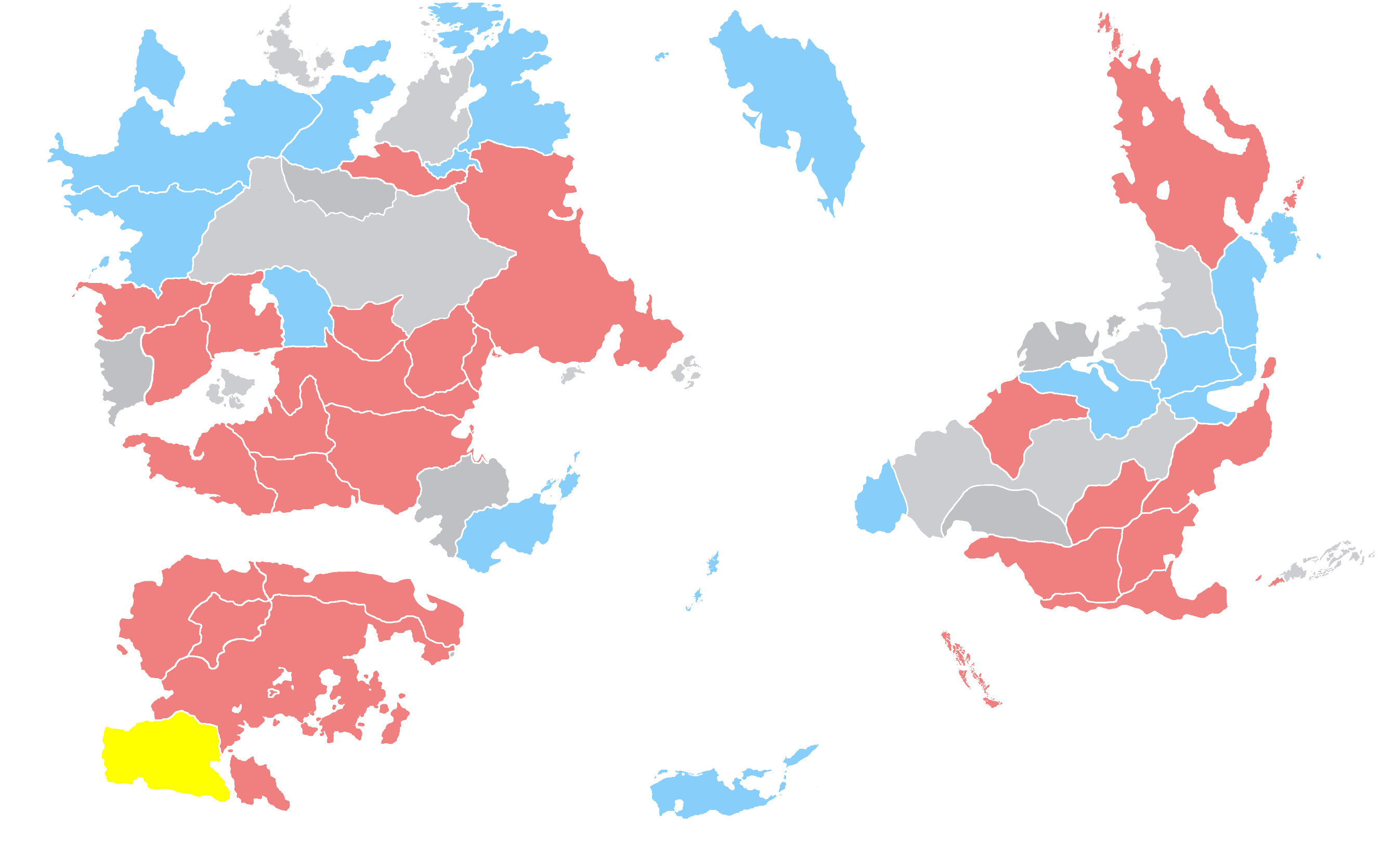 | 2,656 × 1,669 (312 KB) | Leimur (talk | contribs) |
You cannot overwrite this file.
File usage
The following page uses this file: