File:Municipalities of Monsilva.png
Jump to navigation
Jump to search

Size of this preview: 800 × 578 pixels. Other resolutions: 320 × 231 pixels | 2,544 × 1,838 pixels.
Original file (2,544 × 1,838 pixels, file size: 851 KB, MIME type: image/png)
Summary
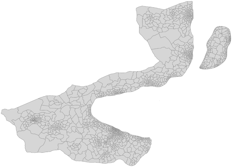
A map of every municipality in Monsilva
File history
Click on a date/time to view the file as it appeared at that time.
| Date/Time | Thumbnail | Dimensions | User | Comment | |
|---|---|---|---|---|---|
| current | 14:28, 24 January 2024 | | 2,544 × 1,838 (851 KB) | Leimur (talk | contribs) | |
| 16:38, 31 March 2023 | 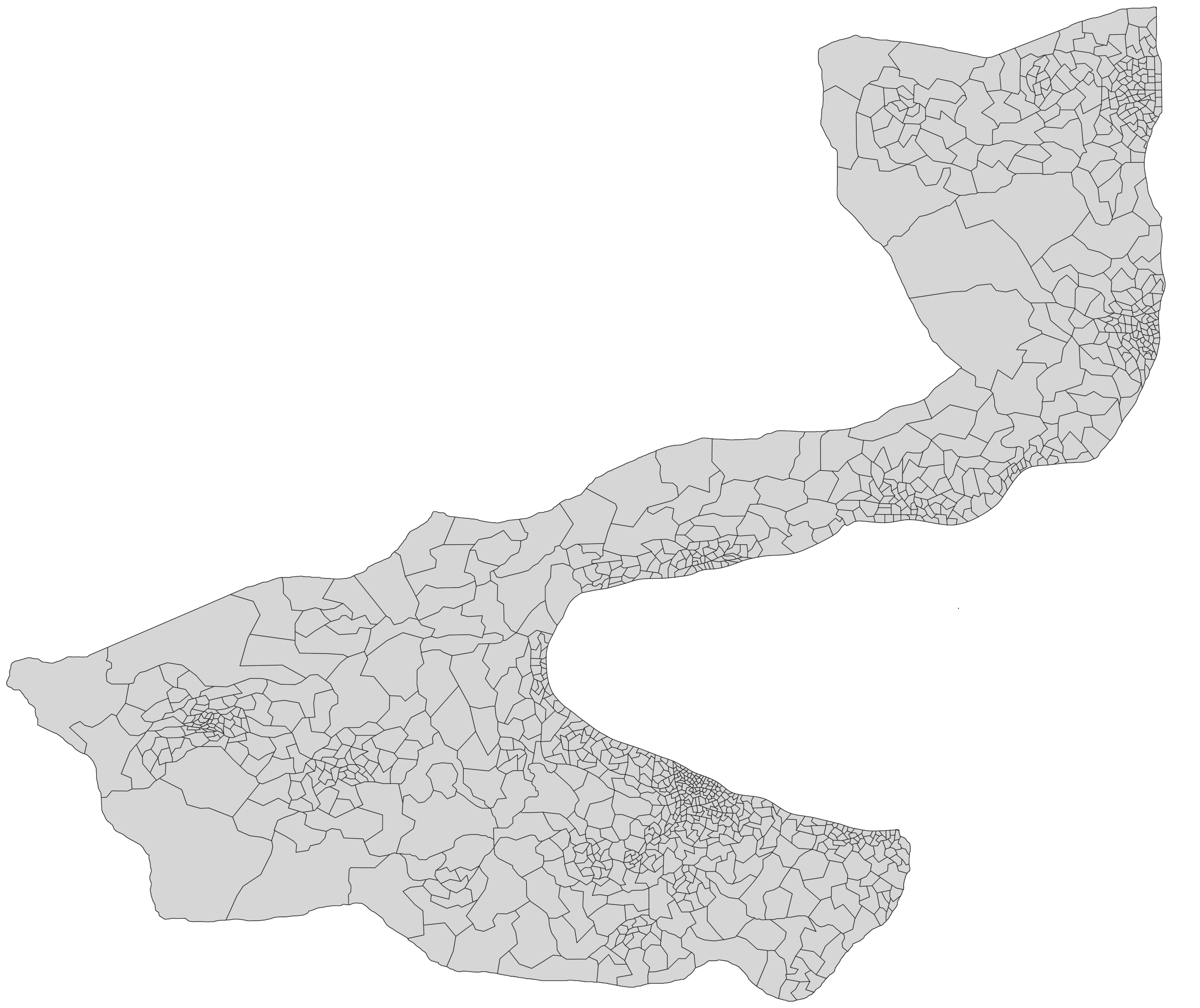 | 2,544 × 2,137 (916 KB) | Leimur (talk | contribs) | ||
| 18:13, 7 December 2022 |  | 2,156 × 1,991 (122 KB) | Leimur (talk | contribs) | ||
| 18:09, 20 November 2022 |  | 2,156 × 1,991 (108 KB) | Leimur (talk | contribs) | A map of every municipality in Monsilva |
You cannot overwrite this file.
File usage
The following 2 pages use this file: